Special Use Airspace
Permission is required.
Special Use Airspace is an area designated for operations of a nature such that limitations may be imposed on aircraft not participating in those operations. Often these operations are of a military nature.
From Wikipedia – Special Use Airspace
Special use airspace includes: restricted airspace, prohibited airspace, military operations areas (MOA), warning areas, alert areas, temporary flight restriction (TFR), national security areas, and controlled firing areas.
Restricted Airspace
Restricted Areas are areas where flight is highly restricted. They are usually restricted due to hazardous operations, like missile launches, air combat training, and artillery firing.
They may not always be “active”. You can check the times and altitudes on a sectional chart.
Restricted Areas have a blue hatched border and they’re labeled starting with the letter “R”. In this example, “R-4808N” is the highlighted Restricted Area.
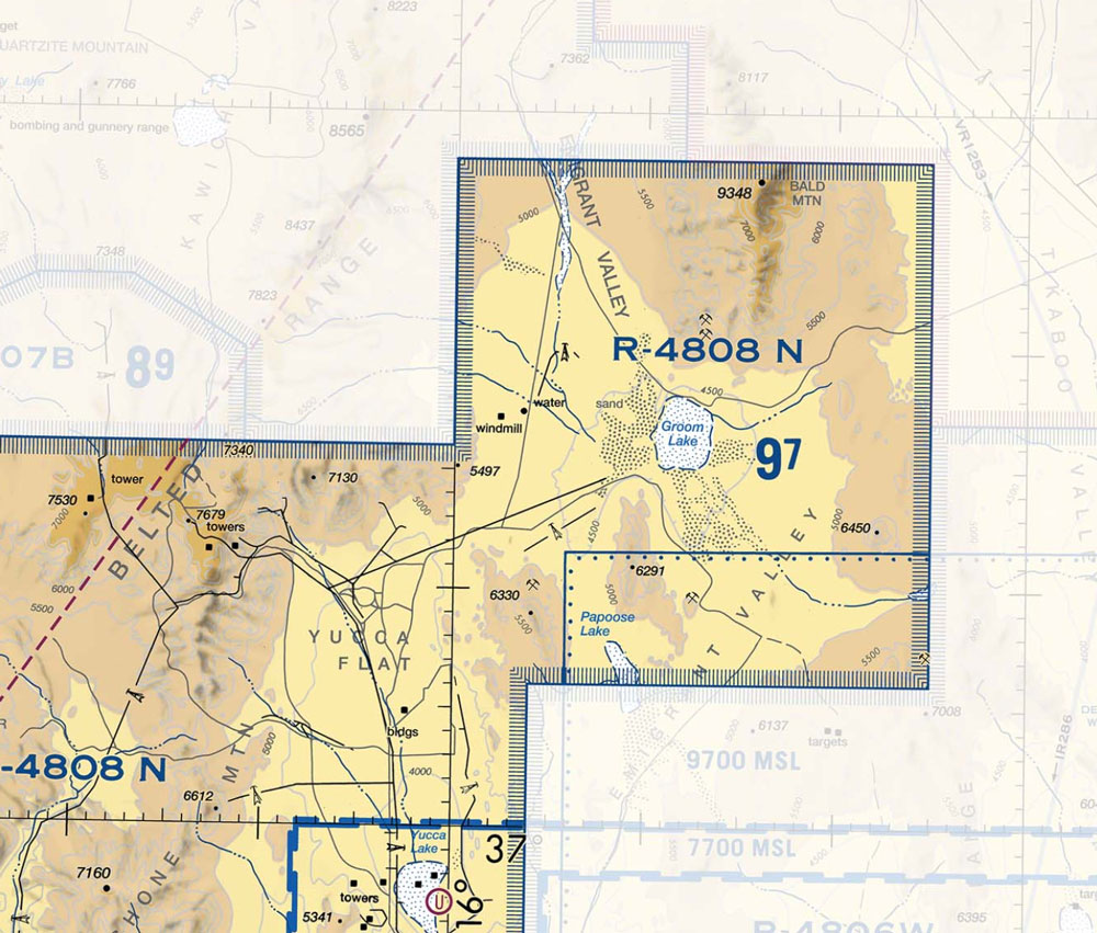
On the sectional, you can find the details for each restricted area by number.
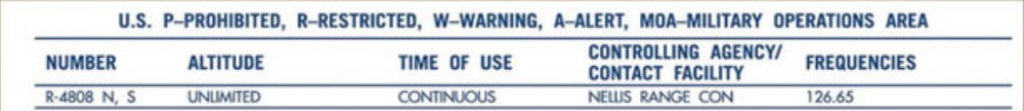
Looking at the sectional chart for R-4808 N, S you can learn the following information:
- Restricted Area Number: R-4808 N
- Altitude (in MSL): Unlimited
- Time of use (in local): Continuous
- Controlling agency: Nellis Range Control
- Communication frequency: 126.65
Unlimited altitude and continuous time of use tell us that it’s not likely we would get permission to fly in this area.
Prohibited Airspace
Prohibited Areas are places where flight is prohibited. These areas are created for national security reasons, as well as to protect the environment. Here’s the official definition from the FAA:
Prohibited areas contain airspace of defined dimensions identified by an area on the surface of the earth within which the flight of aircraft is prohibited. Such areas are established for security or other reasons associated with the national welfare. These areas are published in the Federal Register and are depicted on aeronautical charts.
FAA

The sectional chart will contain details of the Prohibited Area, including:
- prohibited area number
- altitude (MSL)
- time of use (in local)
- controlling agency
- communication frequency
When it comes to Prohibited Areas, it’s probably best to stay far away! Stay at least 10 miles away and pay close attention to ensure you don’t fly into one of these areas.
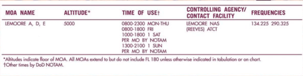
MOA – Military Operations Areas
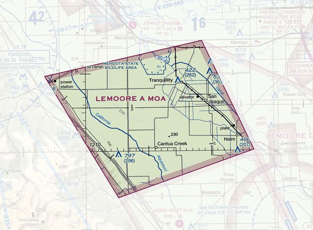
With proper planning and communication, we can fly in MOAs. Beware of military traffic in these areas. We are SLOW and they are FAST!
MOAs have a hatched border just like restricted areas but instead of blue, they are magenta. MOAs also have a specific name. In the example below, “LEMOORE A MOA” is the highlighted MOA.
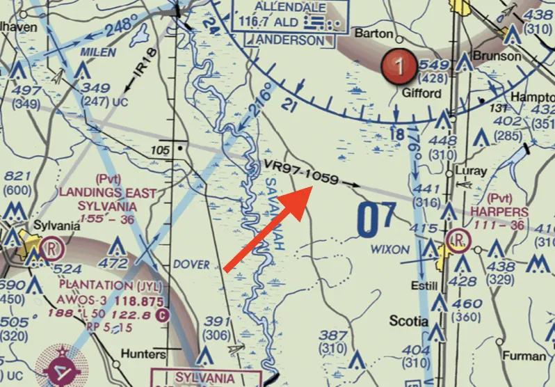
Military Training Routes
MTRs are depicted as thin, light gray lines on the sectional. Each has its own identification, and the identifier has two parts. “VR” means that pilots flying the training routes will be flying under visual flight rules. “IR” means the pilots will be flying under instrument flight rules (look out for these guys – they are looking down at their instrument panels). The second part of the identifier is either a three or a four-digit number. Four digits mean the route will be flown at or below 1500 feet AGL (a dangerous route for Paramotors). A three-digit number means the route will be flown above 1500 feet AGL.
Alert Area and Special Flight Rules Area (SFRA)
A special flight rules area (SFRA) is a region in which the normal regulations of flight do not apply. You’ll need to check on the sectional to see what the special rules are for that specific SFRA.
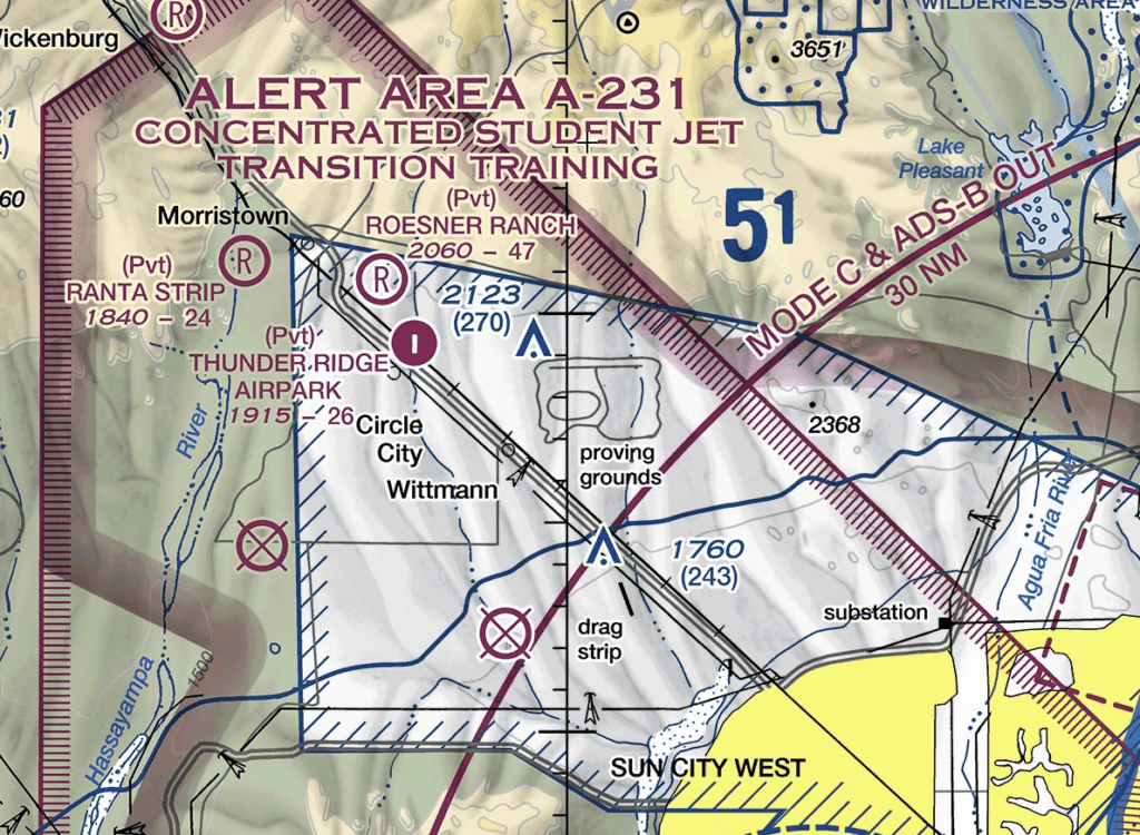
Alert Areas
Alert areas look like Restricted or Prohibited areas but they will say ALERT AREA instead. We can enter alert areas without prior permission. They will usually explain why they are alert areas.
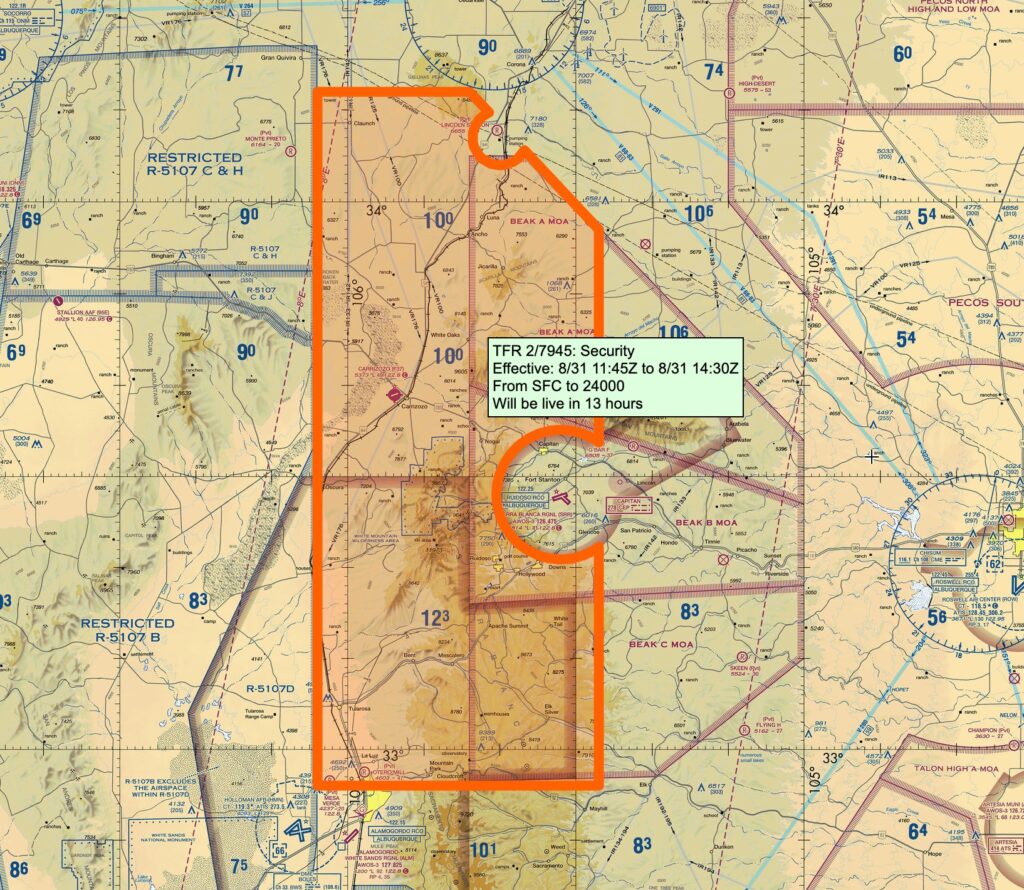
Temporary Flight Restrictions (TFR)
TFRs can pop up with little or no notice. It’s important for you to check for TFRs every time you fly. In the summer, wildfire TFRs are commonly established to protect aerial firefighting crews.
You can check tfr.faa.gov or skyvector.com to see if there are any TFRs in your area.
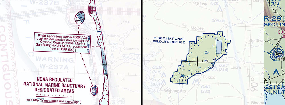
Wildlife Areas
Wildlife and Wilderness Areas – Special conservation areas protect national parks, recreational areas, monuments, and other areas that paramotors should try to avoid. They are identified by a blue line with blue dots on the inside. The name of the wilderness area is usually listed in or near the area. We are “requested” to maintain at least 2,000′ AGL above these areas. Paramotor pilots have received citations for flying too low in these areas.
If you fly near a coastline you need to be aware of marine sanctuaries. NOAA regulated marine sanctuaries are identified with a magenta line, with magenta dots on the inside. Marine sanctuaries have a box near them that identifies the minimum altitude for overflight.